My acquaintance with mountain trails began with participation in the mountain race "Goverla Race", but after it, I could not get to such a race. This year he decided to fix it, and pay attention to mountain racing, and at the same time add a little variety to his running adventures.
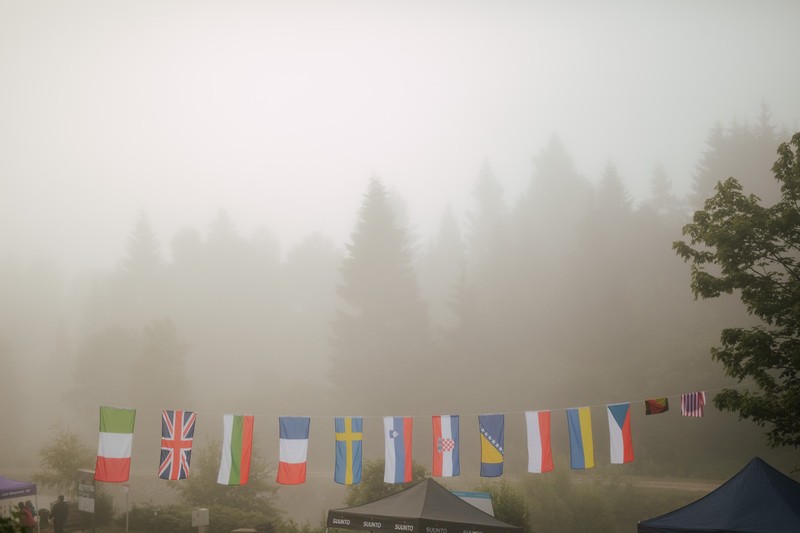
Due to modern realities, he decided to look for an interesting mountain race on the territory of Croatia. Getting acquainted with Croatian races, my attention was quickly drawn to an interesting trail series called "Kvarner Trails Series" and its mountain race "Risnjak Trail". As for the "Risnjak Trail", the race interested me for several reasons, namely that it had a short main distance - 30 kilometers with an altitude of 1733 meters and the fact that it is one of the stages of the "Golden Trail National Series" in Croatia.
That's why participating in the "Risnjak Trail" gave me two interesting opportunities, to run a foreign mountain trail and at the same time take part in the "Golden Trail National Series", so I didn't think long about whether to run the "Risnjak Trail" trail or not.
Registration
You can register for the “Risnjak Trail” through the official website of the “Kvarner Trails Series” - kvarnertrails.com, where the participant can choose one of two distances, namely the main one - 30 kilometers (distance participating in the “Golden Trail National Series”) and an additional distance of 17 kilometers. The cost of registration for the race is from $ 30 (early - 200 kuna and late - 250 kuna).
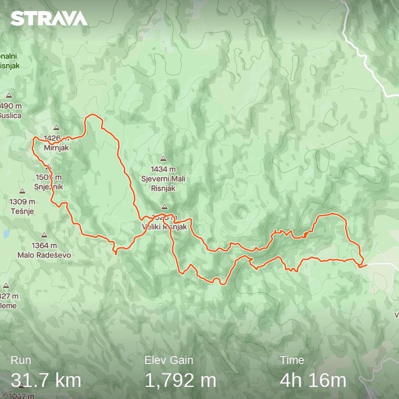
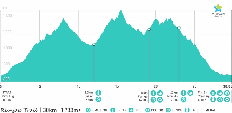
The "Risnjak Trail" route passed through the territory of the Risnjak National Park and consisted of a distance of 30 kilometers from one circle and a set height of 1733 meters. In addition, the trail participants had to climb to the highest peaks of the park, namely Big Rysnyak (1528 meters (ascent to an altitude of 1400 meters)) and Snezhnyk (1506 meters). Those participants who ran the main distance - 30 kilometers, had to carry the obligatory equipment whistle, isofol, water. There were 3 food outlets (12.3, 19, and 23 kilometers) on the trail route, where participants could regain their strength. It took 7 hours for the participants to cover the distance, in addition, the trail distance was divided into 4 segments which also had their own time for which the participants had to overcome them, namely the first segment (12.3 kilometers) had to be covered in 2 hours 30 minutes, the second the segment (7 kilometers) - 2 hours, the third (4 kilometers) - 1 hour and the equipped fourth segment (7 kilometers) - 1 hour 30 minutes.
Run
After successful registration on the "Risnjak Trail", it's time to plan your trip to Croatia. The nearest resorts to the trail are in Rijeka and Pula. Although Rijeka was closer, there was a more expensive flight and flights were only on Tuesday, which was not very convenient, so I decided to choose Pula, as there was a slightly cheaper flight and flights were on Thursday, which made its airport for me more attractive.
As for crossing the border, there were no surprises, you had to present receipts for full payment of hotels where you plan to stay, a negative test for Covid-19 was made no later than 72 hours before crossing the Croatian border and register on enter Croatia, and present the registration number of the application (printed) to the border guard. There are two ways to get to Pula from the airport by taxi or Pula Shuttle Bus. The cost of a taxi to the city center is about - 100 kuna, and by bus - 30 kuna.
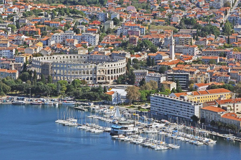
After arrival, I was waiting for a walk and acquaintance with Pula. I really liked the city, as there are many well-preserved architectural monuments (ancient Roman amphitheater, forum, triumphal arch, Church of Augustus, town hall, St. Nicholas Church and Castel Fortress), and a walk through the streets of the city and drink coffee among old houses while wasting time was quite interesting. After admiring the architecture of Pula for a while, I went on the next day, as my next stop in Croatia was in the town of Delnice.
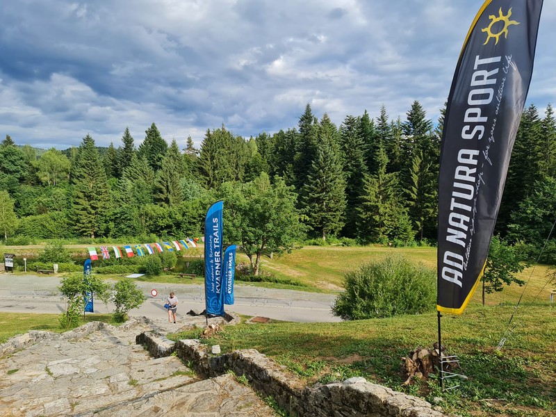
Between Delnice and Crni Lug, the final destination of my journey is 12 kilometers. You can get to Crni Lug from Delnice by taxi or on foot. I decided to choose the hiking option for myself, as I wanted to take a walk and admire the surrounding nature, and at the same time warm up a bit in front of the trail.
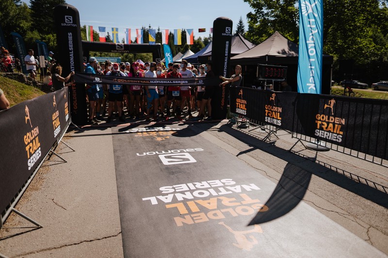
Trail participants could receive their starting package both the day before the start and on the day of its holding on the territory of Risnjak Park. So when I got to Crni Luh on the same day I went to the starting town to get my starting package in advance. On the day of the start, which was a Saturday morning, I started by packing my running backpack, and there quickly formed an isoform, a whistle, a jacket, a buff, and a power bank. As for water, like "Kyiv Trail" showed, one liter of water for a distance of 30 kilometers was not enough, so this time I decided to take 1.75 liters (2 bottles of 0.5 liters and one of 0.75 liters), which have been cooled since the evening. refrigerator.
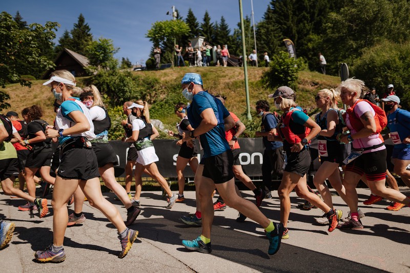
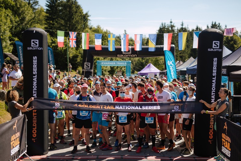
After collecting running things, I slowly went to the starting town, where the participants of the trail arrived in the morning. Something special did not happen here, some participants received starter packs, others warmed up while the host talked about the features of the trail, the participants from which they came and the sponsors of the trail, in short, everyone was waiting for the start, which was to take place at 10 o'clock. The start for the participants for the distance of 30 and 17 kilometers was joint.
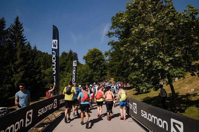
At 10 o'clock the participants of the "Risnjak Trail" went to meet the running adventures, and for me, my second and first foreign mountain trail began.
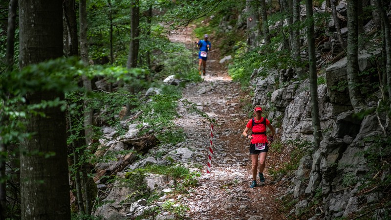
To overcome the first 12 kilometers of the trail route, participants were given 2 hours and 30 minutes, in addition, on this section they were waiting for the biggest ascent, which led to the top of Big Rysnyak. The ascent to the top began about one kilometer after the start and lasted up to 8 kilometers and had an altitude of 800 meters. If the beginning of the trail was on a wide road, the ascent itself was on a narrow path, where participants ran one after another. It was difficult to overtake someone on this section of the route as there was a mountain on one side of the trail and a slope on the other.
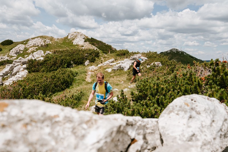
At the top of Big Rysnyak, the route for different trail distances diverged, and then the participants ran separately for 30 and 17 kilometers. After the participants climbed to the top of Velykyi Rysnyak, they were expected to descend 4 kilometers to a height of 1,100 meters. The first food point was located at the end of the descent from Big Rysniak and before the ascent to Snezhnyk. On it, participants could regain a little strength with the help of water, when and isotonic.
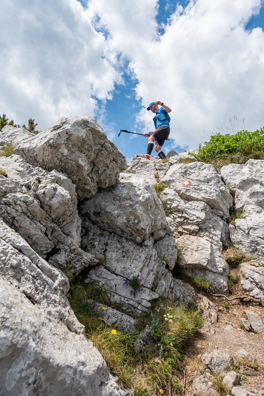
After the first food point, the participants had a second segment of the 7-kilometer trail waiting for them, and the participants were given 2 hours to conquer this segment. As for the segment itself, it was somewhat similar to the previous one, where the first hour of ascent (3 kilometers) only this time it was the top of Snezhnik (1506 meters (a set of about 400 meters), and then the descent from it to 1200 mayors. descent and before the third big ascent there was a second food point, where participants in addition to water, when and isotonic, could also taste a variety of delicious fruits (banana, orange, watermelon), cookies, and cheese.
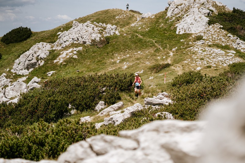
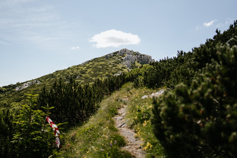
The third section of the trail was 4 kilometers long and took 1 hour to overcome. In this section, it was necessary to ascend to the top of Big Rysnyak again and descend from it in the direction of the finish. As for the third food point, it was located at a distance of 23 kilometers and here the participants could eat water, cola, isotonic, fruit, and cookies.
The final section of the trail consisted of a 7-kilometer descent, in addition, about the last 2 miles of the trail route passed on the asphalt. As for me, I managed to overcome the first part of the trail in 1 hour and 50 minutes, the second part I spent 2 hours, the third - 1 hour. And in general, cross the finish line of the trail "Risnjak Trail" after 5 hours 50 minutes after its start. Therefore, I was satisfied with my result and the trail itself. I can single out the fact that in some places it was difficult to run without sticks, in addition, if the ascents were more or less normal, then there were some problems with the descents, especially if they were steep and rocky. And running a mountain trail in road sneakers was not a good idea, especially after 21 kilometers, when the feet began to walk every stone, and on the slopes was not very comfortable.
Impression
The mountain trail "Risnjak Trail" turned out to be quite interesting and left only positive impressions. First of all, because of a very interesting route (three very cool climbs), beautiful nature, and good organization of the trail. Separately, we can say that the territory of the park "Risnjak" is quite clean and it is difficult to find any garbage. As for the marking of the trail, its route was mainly along the marked hiking trail, so when marking the route in addition to the tourist markings, which were applied to tree trunks and stones (white and red circle), the organizers still used red and white ribbon and signs indicating running direction.
Thank you for reading, I hope you found it interesting.
If you have any thoughts or opinions on this article then I'd love to see your comments.
Check out my website for more of my work.
Comments